The Kalymnos Trail
A 38-hour journey to circumnavigate the Greek island of Kalymnos.
To truly begin at its root, we have to start this story in January of 2022 with a classroom discussion on the novel Fight Club by Chuck Palahniuk. I was using the book in the Comparative Literature class I teach at The Climbing Academy (TCA), and the students were intrigued by Palahniuk’s message of living in the moment, something they strive to do every day as climbers, travelers, and learners. On this day, we were discussing a moment in the novel when one of the characters – who is speeding down the wrong lane on the highway – threatens to crash the car if the book’s narrator doesn’t immediately confess his greatest unrealized dream.
Near the end of the discussion, I asked the students what they would say if they had to confess their deepest desire to save their life. Some mentioned climbs they wanted to send, some mentioned trips they wanted to take, and some mentioned professional and academic goals. When everyone had gone, one of them asked, “What about you Kieran?”. Caught off-guard, I replied with the first thing that came to mind. “I think I would say that I want to walk a really long way through some foreign country.” A few of the students laughed, and one even chided me for not taking the question seriously, but my answer was honest. I’ve always been inspired by epic journeys – the ones in which people find themselves completely alone in an unknown place at the limits of their endurance and still manage to push forward. I wanted to have that kind of experience, to explore new places both in the world and within myself.
A month later, I flew to the Greek island of Kalymnos, a mountainous and remote Mediterranean paradise. I was to be there for two months with TCA to experience some of its otherworldly sport climbing and its idyllic seaside atmosphere. But as I perused the guidebook, I chanced upon a little section describing something called “The Kalymnos Trail”, a 65-mile path that circled around the island and summited several of its tallest peaks. Recalling Fight Club, I decided I had to make it happen.
The Grande Grotta, arguably Kalymnos’ most iconic crag.
As a teacher at TCA, my bosses magnanimously allow me one full day off per quarter. Thanks to my teaching schedule and the willingness of a couple of my coworkers to help me bend the rules, I managed to gain a second full day with which to do the Trail. I planned my two-day excursion for the first week of April when the weather would be neither too hot nor too cold for trekking and bought a map and a guidebook. The day before I left, I made six peanut butter and jelly sandwiches and bought five plastic 1-liter water bottles to bring with me. Knowing I would need to spend a night halfway around the island, I called a tavern in the hamlet of Palionisos to see if I could find accommodation. On the other end of the line, a man picked up. After I introduced myself, he excitedly told me that he had “many American friends” and that he made good hot dogs so that I could have a taste of America when I visited. He told me there were no options for lodging but that he had a tent in his backyard that I could sleep in, weather permitting. With this detailed plan and my thorough day-before preparation, the day of my departure had arrived. The night before, I set an alarm for 4 am, said goodbye to the kids, and went to bed.
In hindsight, I can see that I was drastically underprepared for this excursion. At the time, I was under the impression that 65 miles of hiking would be a simple undertaking compared with the difficulty of climbing at your limit. In my mind, “hiking” was synonymous with middle-age, white calf socks, trekking poles and those awful freeze-dried meals. So to my pretentious ears, the guidebook’s assessments of almost every section of the Kalymnos Trail as “hard” or “very hard” sounded exaggerated and I expected a fairly relaxed trip. I also overlooked the part of the book which states that “very strong and experienced hikers might manage the trail in five or six days.”
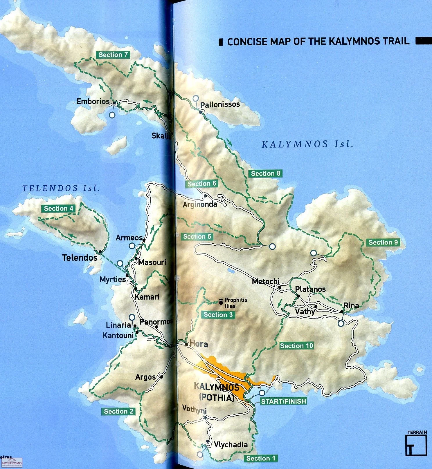
A map of the Kalymnos Trail from the guidebook written by Carl Dawson. I started my trip from Masouri.
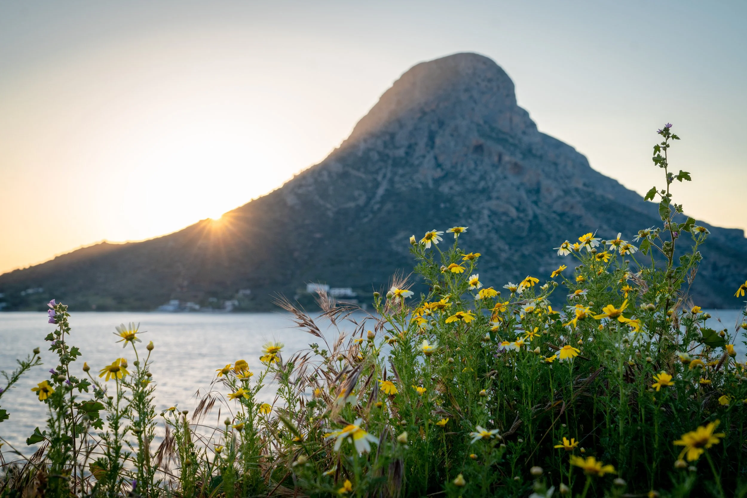
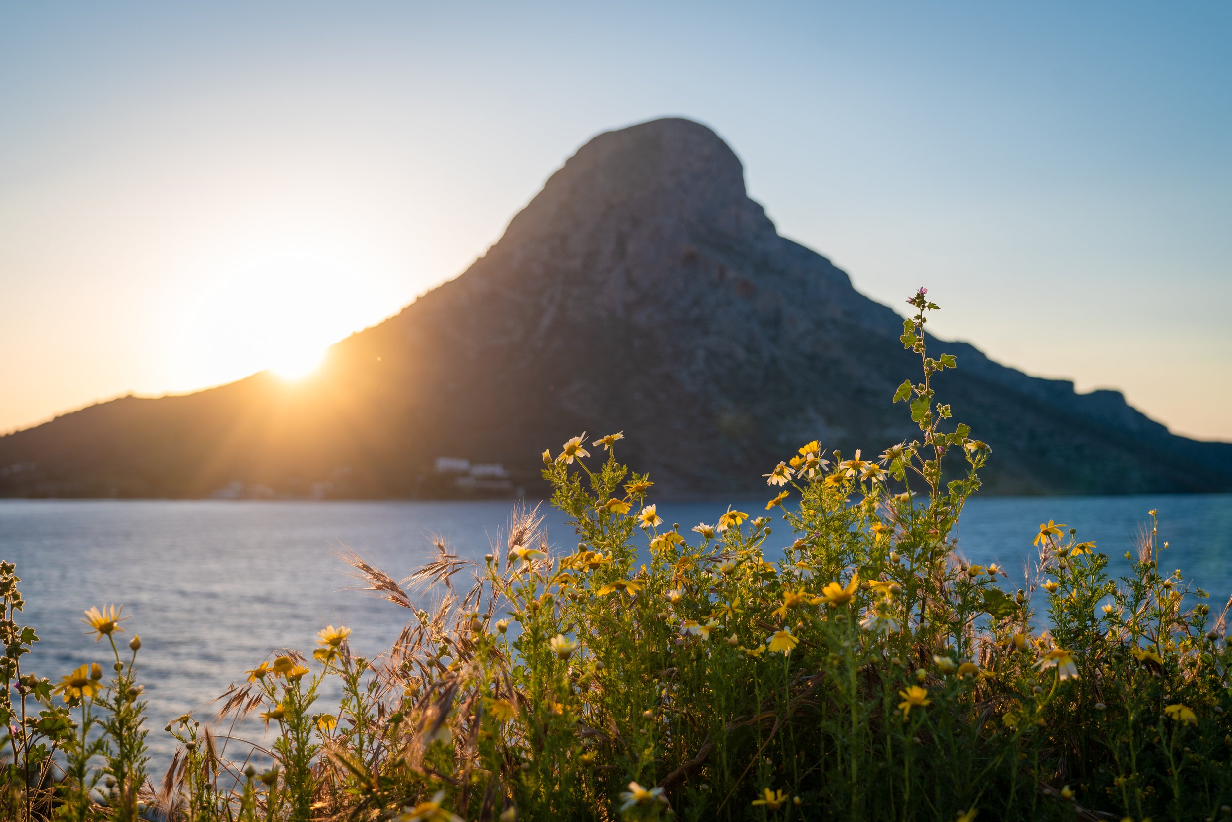
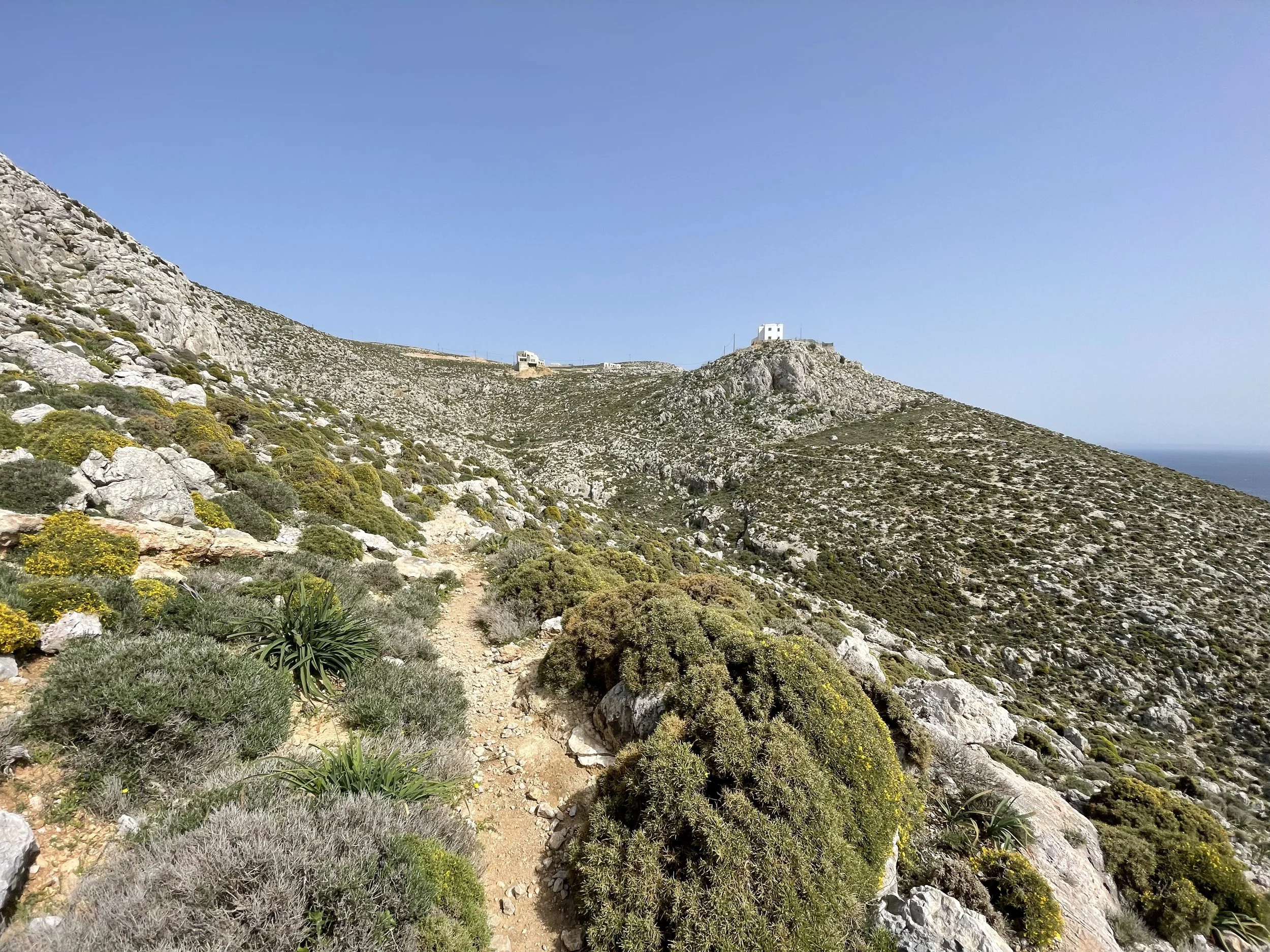
When I awoke it was dark, and I felt that I should be tired but my anticipation for the day made me feel wide awake. I walked to the kitchen and quietly brewed myself a coffee, careful not to wake the students sleeping nearby. Then I brushed my teeth and double-checked my pack before hoisting it onto my shoulders and walking into what was left of the night. My trip began at the familiar trail leading to the Grande Grotta, one of the most iconic crags on the island. The steep, loose path became more visible the higher I went. In the steely blue light of a cloudy dawn, I made quick progress up the precipitous slope of the massif, going past the Grotta and up fields of scree and boulders to the lip of a broad plateau overlooking the town of Masouri. The light tinkling sound of goat bells greeted me at the top and silvery light illuminated the cirque of peaks ahead of me.
The plateau stretched ahead of me and was occupied exclusively by herds of goats and low, spiny shrubs and herbs. To the east it rose up to become the sides of a mountainous ridge. I followed a dry streambed east until I found a faint goat trail that switchbacked up the side of the ridge to find the summit of its westernmost peak, Hondro Kephali, at 560m above sea level. From this vantage point it was possible to see the spine of mountains pointing north to the tip of the island that I was to follow for the next several hours. I felt strong and confident and hadn’t realized how much farther I had to go, only that I had come this far quickly and efficiently. I continued walking east along the ridge until it dropped to meet a paved road that ran along a pass on the north-south mountain chain. The road was empty and I ate a sandwich near some friendly sheep who grazed and rang their little bells along the side of the road.
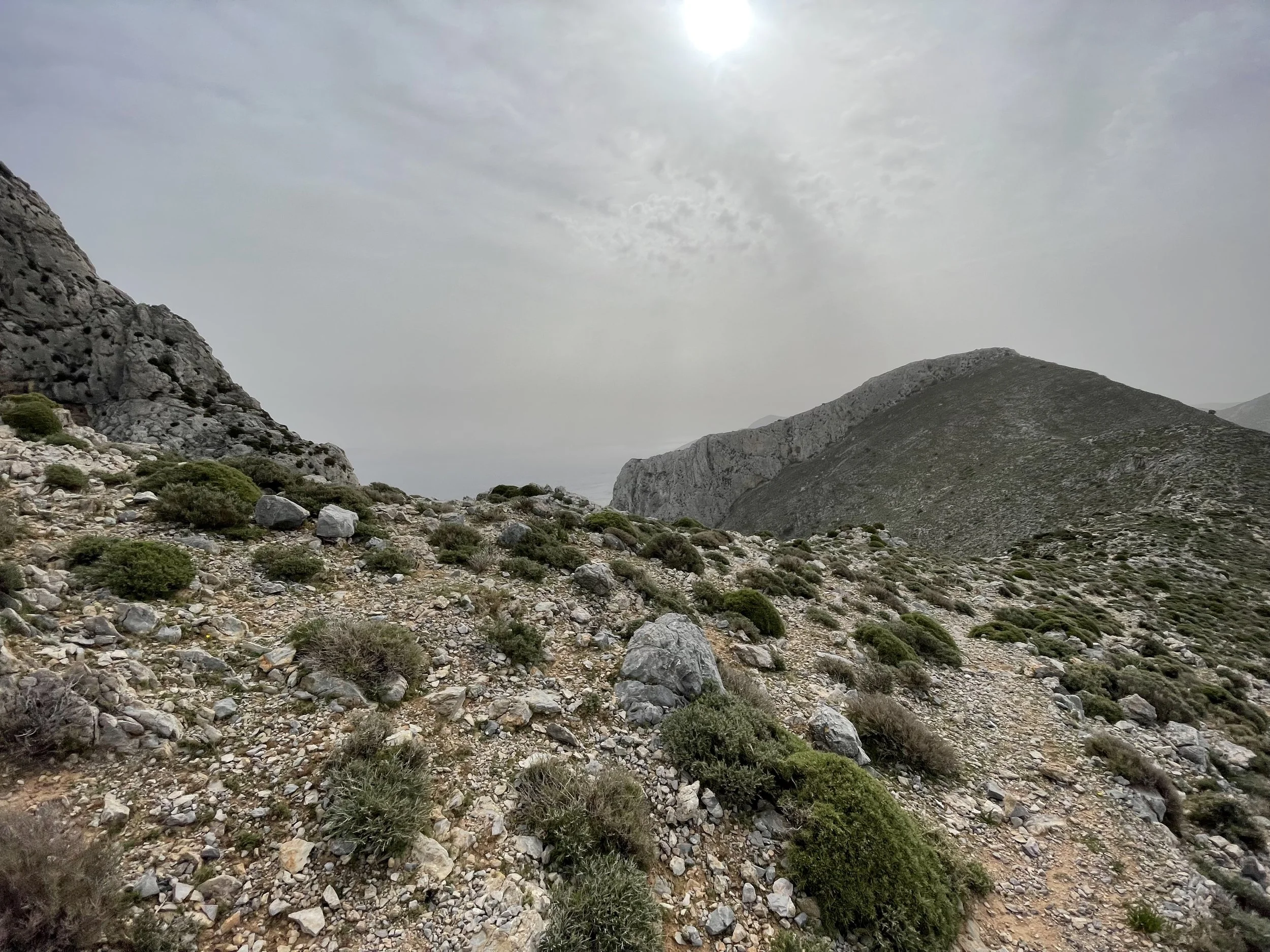

After I left the road the trail angled up towards the flanks and eventual summit of Galatianis at 590m. Before I began climbing the slope of the mountain though, I had to pass through the ruins of a goatherder’s settlement. Within the boundaries of the settlement’s low stone walls the air felt quiet and still, the only sound being the whisper of the wind through the gnarled branches of ancient olive trees. Here and there, little lines of stacked rocks indicated the locations of what were once homes. It felt eerie despite my comfort with solitude. I realized that I was truly alone. After stopping a moment to snap a photo, I clambered over the wall on the far side of the ruins and continued towards Galatianis, my strides quicker and longer than before.
I made fast progress up the broad flanks of Galatianis. I felt confident and motivated and was enjoying the early feelings of exertion. As I began moving to a narrow ridge near the summit, I lost the protection of the mountain’s flanks and was almost immediately blown over by a previously nonexistent westward wind. The ridge – being about 10 feet wide and dropping 1500 feet to the ocean on both sides – was not a good place to be with gusts of 40-50 mph. With each gust, I was pushed a few steps toward the leeward edge of the ridge, after which I would hurriedly angle back towards the trail and brace myself for the next gust. After a half hour of this kind of zigzagging motion, I found myself at the lonely chapel marking the summit of Galatianis. Topping this peak marked the end of what I call the “honeymoon phase” of the Trail, and the beginning of what I will refer to as the “heinous phase” (note: the honeymoon phase lasted only 5 hours while the heinous phase lasted 33).
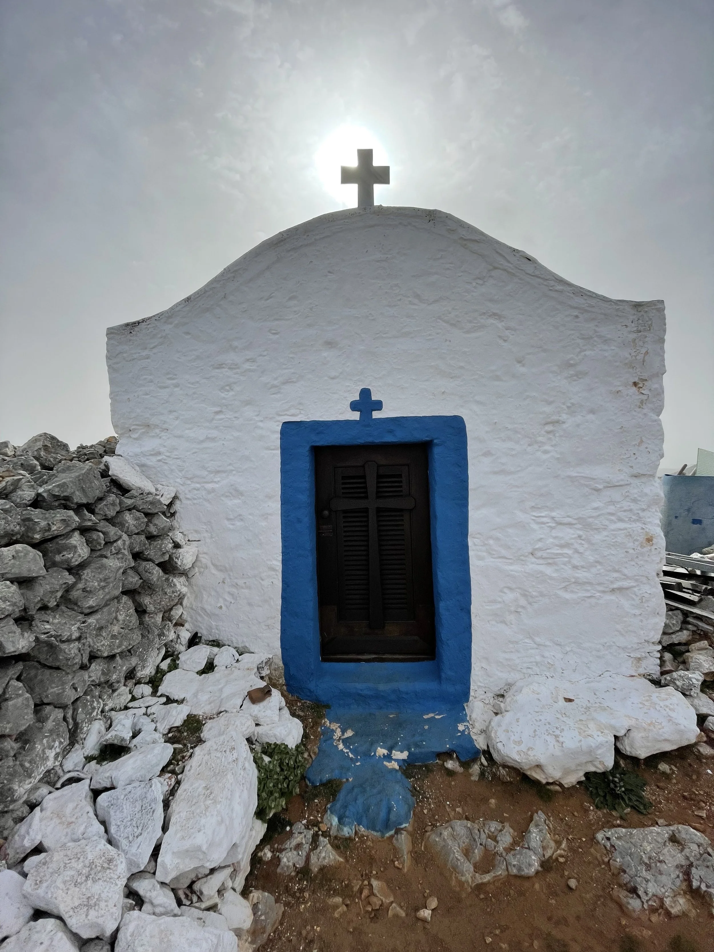
The lonely chapel at the summit of Galatianis.
When I left the top of Galatianis I also left the relatively clear trails that had led me there. My guidebook informed me that rather than following a trail down from the summit, I was to aim for a “distinctive scree field” towards the base of the peak. Any significant deviation from the “awkward and pathless” route traced on my map, the book said, would lead to falling over the edge of one of several tall crags that form the base of the mountain. Because I usually prefer to go up cliffs and not fall down them, I had to proceed carefully. Every step sent a miniature rockslide tumbling down towards the cliff below, and as my footholds slid out from beneath me I had to plant my hands in the sharp brush to keep myself from tumbling with the rocks. My progress in this section slowed to a crawl over the next hour, as I would slide down steep sections of scree towards what I thought was the trail only to find myself a few feet away from a precipitous drop. The wind didn’t help. By the time I made it to the “distinctive scree field”, all traces of my previous comfort and confidence had been replaced with the nervous focus that comes with danger. Spooked and battered from my descent, I was eager to move on to a short, mellow walk down a paved road to the next section of the trail.
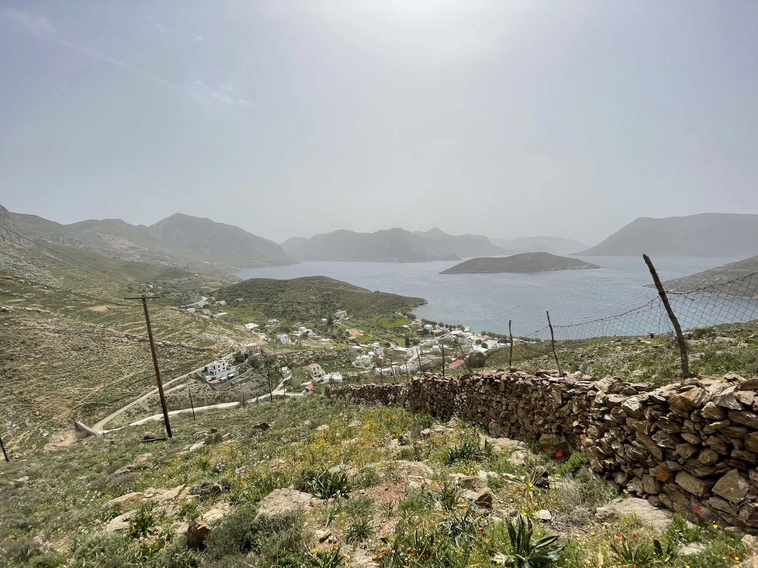
At around 1 pm I arrived in Kalymnos’ northernmost village, Emborios, and convinced a local restaurant owner to make me a sandwich and coffee. At this point I had walked 13 miles, with another 6.5 to go before Palionisos, where I hoped to find lodging in the tavern keeper’s backyard. I was sipping my coffee when my phone rang, with a Greek number displayed on the screen. It was the tavern keeper, who apologetically informed me that although he would happily feed me, he had to leave Palionisos to visit his daughter-in-law at the hospital and thus could no longer offer me his backyard. In my mind this changed nothing – I would sleep on the ground if I had to – but I did wonder where I would stop for the night. After thumbing through the guidebook, I settled on the possibility of Pezonda Bay, a supposedly sandy beach several miles after Palionisos.
Back on the Trail, the wind had been replaced by sweltering heat. I walked out of Emborios and into the first of the barren goat ranges that make up the northern part of the island. I picked my way among smallish boulders and bushes, occasionally stopping to pass through a makeshift gate to access the next range. The brightness of the air and sky began to feel oppressive, and my steps started turning into staggers. The sun’s rays threatened to pierce the barrier of my skin to fry my mind and spirit to a crisp. I felt an imminent mental breakdown but hoped that it could be avoided if I could just make it to the next landmark. As I reflect on this part of my hike, I think there’s an important lesson to be learned. When fatigue, pain, and isolation combine to the point of crushing your spirit, there are two options available to you – you can either succumb to these oppressors and find a place to sit down and cry about how hard your life is, or you can embrace the absurdity of the situation and allow yourself to go a little insane for the sake of pushing forward. I guess because I’m a fan of Camus and personal suffering, I opted for the second option. As I stumbled over rocks and spikey vegetation I yelled at nearby goats in my mediocre Spanish. Every time I felt my pace start to slow and my legs start to crumple I would scream an expletive and trudge as many steps as I could before yelling something else. This strategy worked surprisingly well, and in addition to practicing my Spanish, I made it to the northern tip of the island, where I found an unlikely set of stone steps that took me to the top of the mountain ridge.
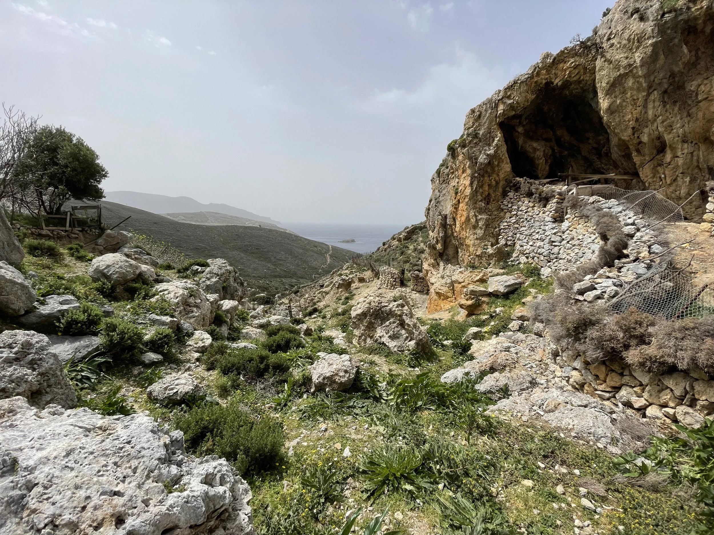
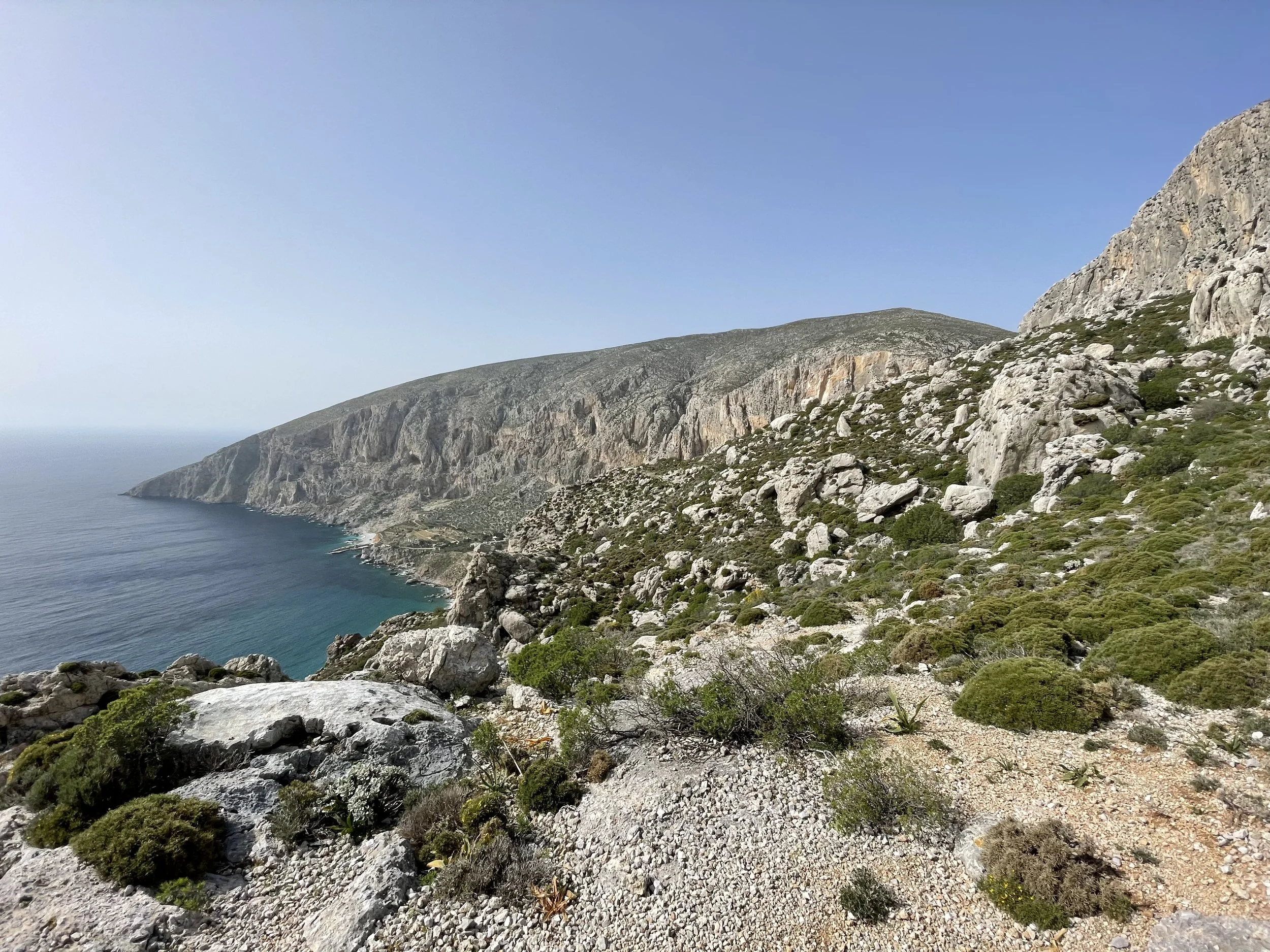
At around 3:30 I descended the eastern slopes to find myself on a precipice overlooking the sunken immensity of the Sikati Cave. One of the most unique crags on the island, the cave is a sinkhole of sorts containing dozens of abstractly featured routes. Inside, I could see the tiny figures of climbers wrestling man-sized stalactites hundreds of feet off the ground. Despite my relief at seeing the impressive feature, I was starting to get a bit nervous. Since leaving Emborios, the trail had become vague, where it existed at all. Mostly, I was operating based on feel and celebrating every time I saw the blue dots occasionally painted on rocks to indicate that I was going the right way. So it didn’t help when, upon leaving the cave, I immediately got lost and spent half an hour trying to regain the trail. At around 5 pm I finally made it to Palionisos, anxious and exhausted.
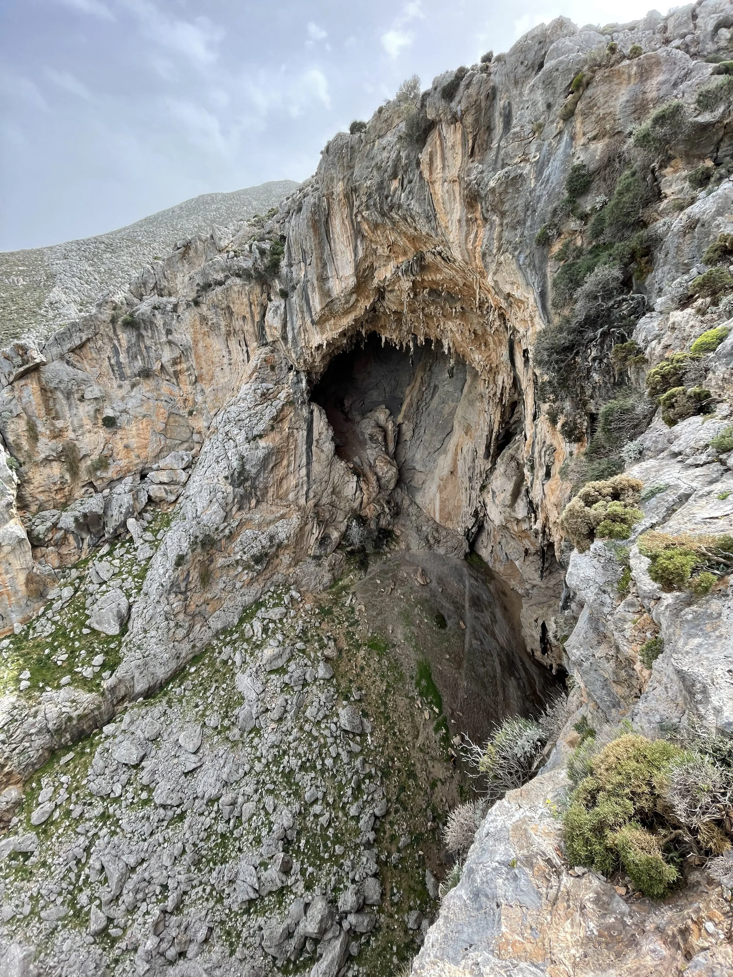
The formidable Sikati Cave.
As I walked into the little hamlet I passed a charming little two-story house where a few elderly residents sat sitting and smoking in the dusty shade of the porch. One of them hopped up from his table and asked if I was the American who had called on the phone. He introduced himself as Nicholas and motioned me over to a cheap plastic table, where he immediately supplied me with water and raisin wine. The yard was pleasantly unorganized, with little vines growing over the shade structure on the patio and about a dozen cats mewling and rolling happily in the grass. Soon, a round, kind-looking woman appeared from inside the house and set a big plate in front of me piled high with tiny fish, fried whole. For a few minutes, I sat and drank and ate and thought about nothing.
Conversation with Nicholas was easy – he would speak for ten minutes straight while I nodded and grunted through a mouth full of fish. Though his wrinkled face and the wispy halo of white hair on his scalp betrayed his years, the brightness of his eyes indicated internal sharpness and deep presence in the moment. I asked him if he had lived in Palionisos his whole life, to which he responded by asking, “Do you see that building over there?” I looked past the tip of his crooked finger and saw a dilapidated one-room shack across the road. “I was born there,” he said proudly. He went on to mention that in the hamlet of Palionisos there were only eight permanent residents, half of whom were here at the table. He explained that until 2011 there was no road connecting Palionisos to the rest of the island, so it was only recently that people were able to easily move away. Most did so, leaving those too old to relocate to take care of the village.
After a few more hors-d’oeuvres supplied by his wife (which they refused to let me pay for), I refilled my water bottles, said goodbye and walked to the beach, where the Trail continued southward down the coast. This next 6-mile section, which I was starting at 6 pm after 13 hours and 20 miles of walking, was said to be the most difficult of the Kalymnos Trail.
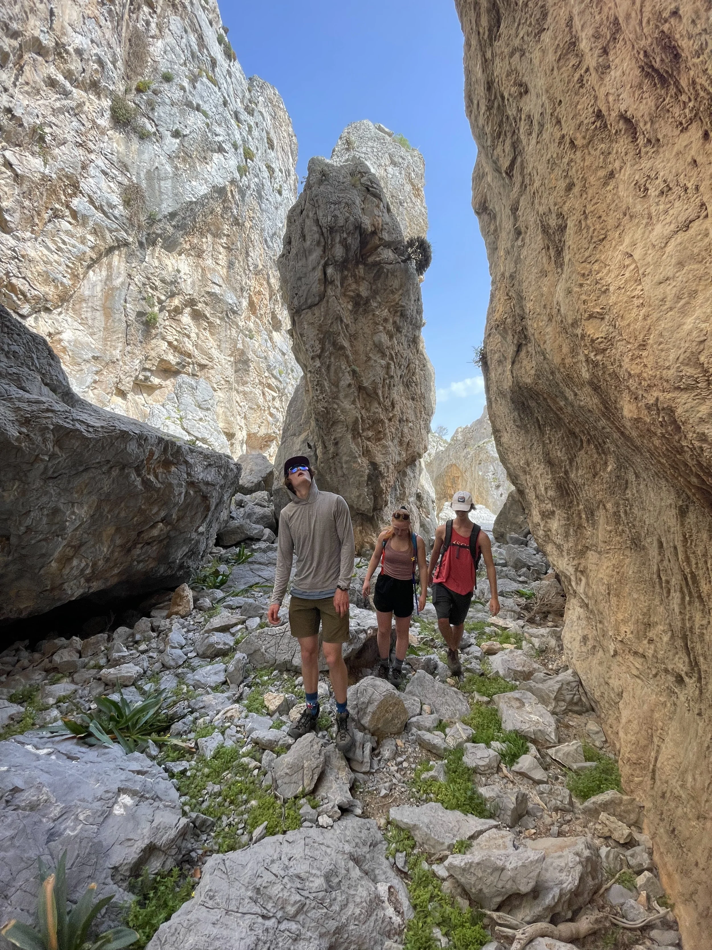
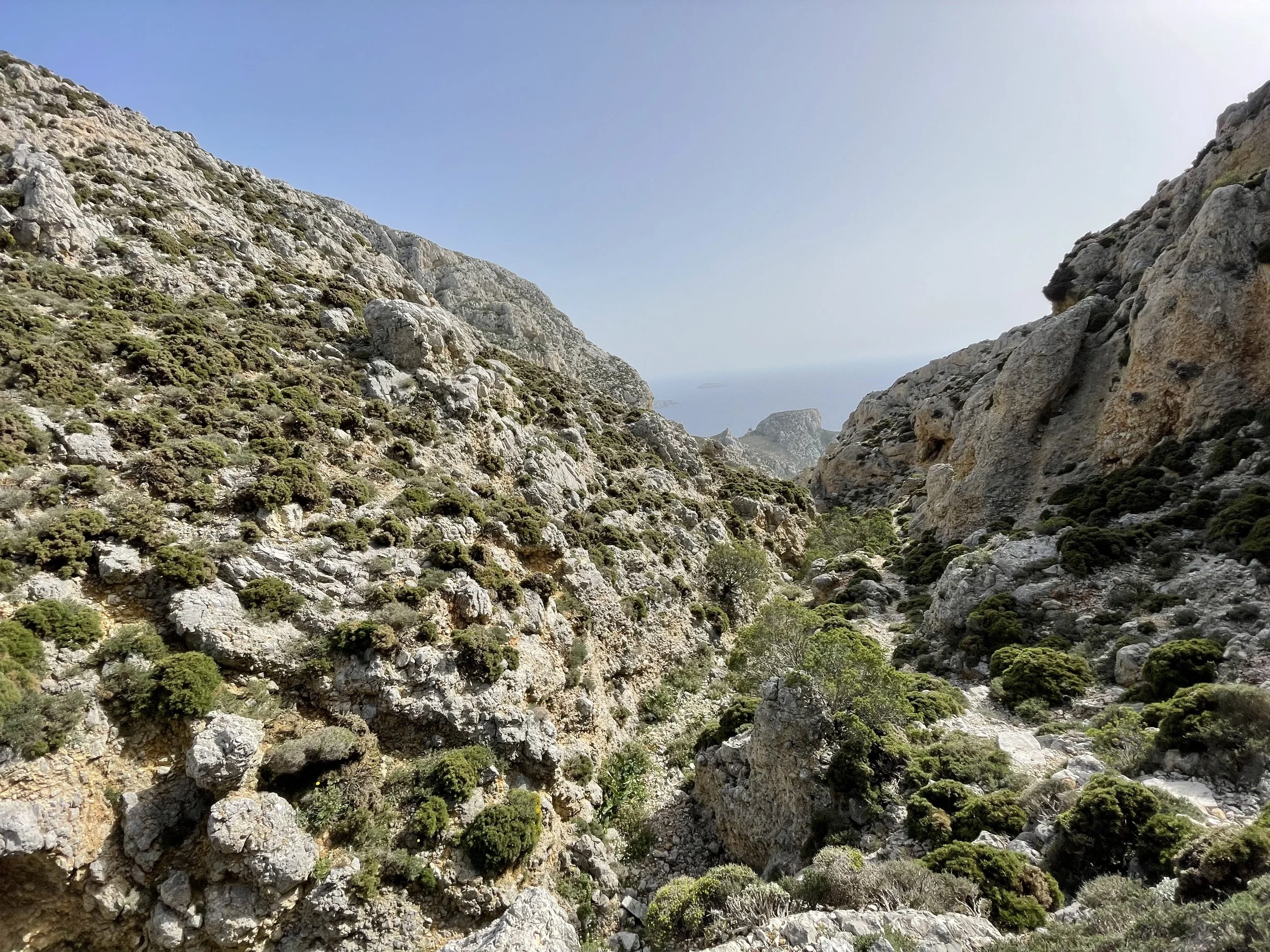
I cut out across the rocky slope of the coast just above where it met the sea, following it through goat pens and over and under sections of craggy limestone cliffs. Gradually, the trail angled to the southwest and away from the water as the slope of the land got steeper and steeper. After losing the trail several times, I found myself on a broad col, less than a kilometer from the ruins I had encountered at the initial slopes of Galatianis 12 hours prior. I began to get worried, conscious of the real possibility that I wouldn’t make it to Pezonda before dark. The shadows were lengthening quickly and I knew that one of the day’s biggest challenges remained between me and the beach. As I continued onwards, the trail went southeastwards towards the sea and become lost in a tangle of juniper trees. I knew then that I had found “The Juniper Maze”.

According to the guide, the Juniper Maze is a section where you “might” find your way through, if you’re really good at reading maps. Despite feeling pretty okay at reading maps, I got lost instantly. The lack of a trail and the density of the forest erases all points of reference, and after a few minutes of wandering through the trees, I dared not double back for fear of losing my sense of direction completely. Completely encircled by juniper thickets, I knew only that I was pointed in a southeasterly direction. Conscious of the fading light and the fact that I still had a few miles to go before arriving at the beach, I abandoned any hope of finding the trail and plowed into the forest in the direction I thought was best. My movement became frantic, and I pushed and clawed against the thin bark of seemingly infinite junipers, very much doubting if this was the best strategy. After about twenty minutes of this anxious bushwhacking, I emerged, covered in spiderwebs and scrapes, into a small clearing in the forest containing a single boulder. I clambered up the boulder and could finally see the landscape around me. To the south, I saw a pattern of clearings that eventually led to a larger break in the forest. I continued clawing my way through the trees and eventually stumbled upon a rock with one of the little blue dots painted on it. After first blinking a few times to be sure it was real, I whooped with joy and began following the obscure path of dots through the rest of the maze.
Though I had found the trail, I was still conscious of the possibility of getting lost again. Where the blue dots did exist, they were painted on rocks that were inside the twisted branches of the junipers, leaving me with no choice but to rip through the branches to find the next dot. And because the distance between dots was rarely consistent, if I couldn’t see one there was no way of knowing whether or not I was lost or if I was simply between dots. Miraculously, I came out the far side of the Maze mostly intact and with a thin band of red light still left on the horizon.
With the light dwindling and my endurance failing, I moved anxiously and quickly towards the last difficult section of this section – a descent through a precise series of ramps and scrambles down a section of cliffs to the sea. Between the maze and the cliffs, I lost the dot trail several times, and by the time I made it to the cliffs the purple light of dusk provided barely enough to see. At this point I was pretty nervous. I had no idea how easy the last section of the trail would be to follow, and even with a headlamp it would be hard to see distant landmarks and dots in the dark. As I began my descent of the cliffs I lost the trail once again, and soon found myself standing on the precipice of an 80-foot face. I could no longer see behind me well enough to spot a dot. Not wanting to get more lost trying to retrace the trail, I turned to a slanted corner on the face and began climbing down, dropping from ledge to ledge in the near-darkness until I managed to find the trail again at the bottom of the cliff. From there, it was relatively simple to traverse another mile and a half to the beach where I had planned to spend the night.
At Pezonda Bay, miles away from any other human, the only sound was the gentle lapping of the ripples of the sea against the rocks and the occasional bleat of far-away goats. The book had led me to expect a soft sandy beach; instead I found fist-sized rocks and driftwood to sleep on. I carefully spread out my towel on the rocks, pulled off my filthy shoes, socks, and shirt, and waded into the water. I stood in the shallows, my headlamp illuminating a vignette of crystal-clear water in the inky darkness of a moonless night. My insignificance in the world was overwhelmingly evident against the map of stars rising from the dark line of the sea.
I spent a few more minutes enjoying the darkness and silence before getting my clothes and washing them in the water. I then waded back to the beach, redressed, and sat on my towel. It was around 11 pm. I ate two of my remaining PB&Js and put my jacket on. I had planned on having a sleeping bag provided by Nicholas, so I had brought no other layers and eventually rolled off the towel to pull it over myself like a blanket. Despite the uncomfortable, uneven surface of rocks and the ants and spiders crawling on my legs, my fatigue allowed me to drift to sleep after 16 hours, 30 miles, and 8500 feet of climbing.
After a fitful few hours of sleep, I awoke in the darkness shivering and sore. I considered going back to sleep but was too cold and uncomfortable so I decided to continue onwards. I checked my watch – it was 4:30 am. The first time I tried to stand, my legs wobbled and collapsed from under me, but the second time I managed to make it up. I slowly ate a sandwich, drank some of my remaining water, and packed my towel and wet clothes into my pack.
Within the larger section of “the heinous phase”, the first 6 hours of the second day could be a subsection labeled “lessons in arachnid intimacy”. Leaving the beach, I walked up a valley that gradually constricted to a narrow slot canyon 20 feet wide and filled with bushes. During the night, the local spider population sets their webs up to cross between the bushes and canyon walls so that every possible passage through the canyon becomes blocked by hairy, aggressive-looking spiders suspended at head height. I’m not a fan of spiders, so I adopted a strategy of stumbling through the canyon while windmilling my arms, shaking my head like a horse, and cursing the spiders with the most colorful words in my vocabulary.
After the spiderwebbed canyon the riverbed broadened once again into a bigger valley. In the darkness I lost the trail once again, and after wasting about half an hour going up the wrong side of the valley I finally spotted a path zigzagging up the other side. With relief, I turned and went up this path, which was one of the most defined I had seen since the beginning of my journey. At this point my spirits began to lift. Coming out of the valley, I walked across a plateau of red earth and spiny shrubs as the white specter of the sun rose behind a screen of clouds.

By now I had become accustomed to the lack of a trail and my lower legs were numb to the ceaseless scratching of thorns and branches caused by walking across the abrasive landscape. So when I arrived at the next valley and discovered that, according to the book, there was no path across, I took it literally in stride. In my mind, nothing mattered anymore but completing the next 20 miles before nightfall. I descended into the valley and picked my way between boulders and gnarled olive trees to scramble up the low band of rock marking the next checkpoint of my journey. By the end of this section I had completely given up on trying to avoid the spiders, and no longer tried to get rid of them — I decided that if they wanted to cling on to my sweaty clothing, I would accept them as fellow travelers on my quest.
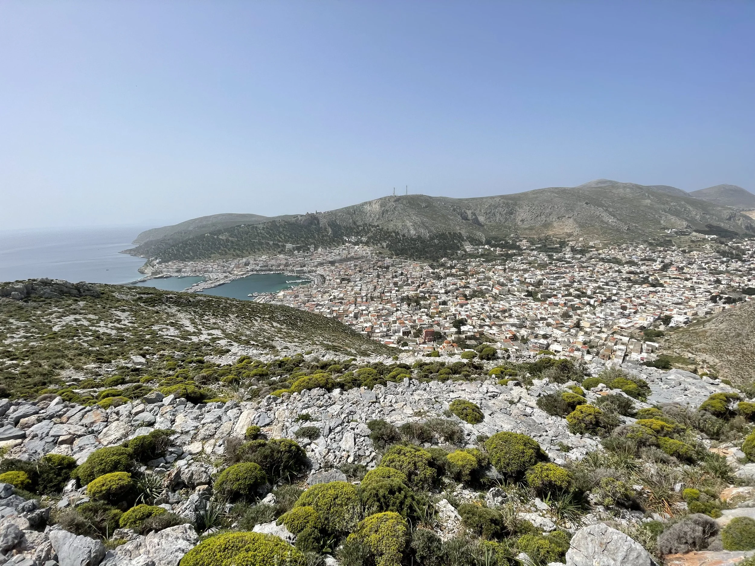
For the next several hours I put my head down and trudged on, following barbed wire fences and the occasional blue dot southwards along the barren coast. It was a hot day and the sky and landscape were soon blindingly bright. With every laborious step little puffs of dust rose up from my feet. I passed through the small town of Vathy and a couple of hours later the Kalymnian capital, Pothia. Refreshed, both mentally and physically after having coffee and lunch, I walked along the road leading out of Pothia and down along the coast.
As I walked down the road out of Pothia, the world seemed richer and more vibrant than it had before, possibly due to the coffee I had drunk there or my relief to be principally among two-legged animals again. I passed a woman crying softly into her phone as she overlooked the sea, a mother and her son playing in the waves, and a happy couple caressing and laughing together on the beach. After my short but intense period of isolation (and the general isolation I experience with my lifestyle), these sights filled me with a strange sense of longing. They were vivid reminders of everything you miss with a lifestyle of constant movement, and of the sacrifices you make when you refuse to settle.
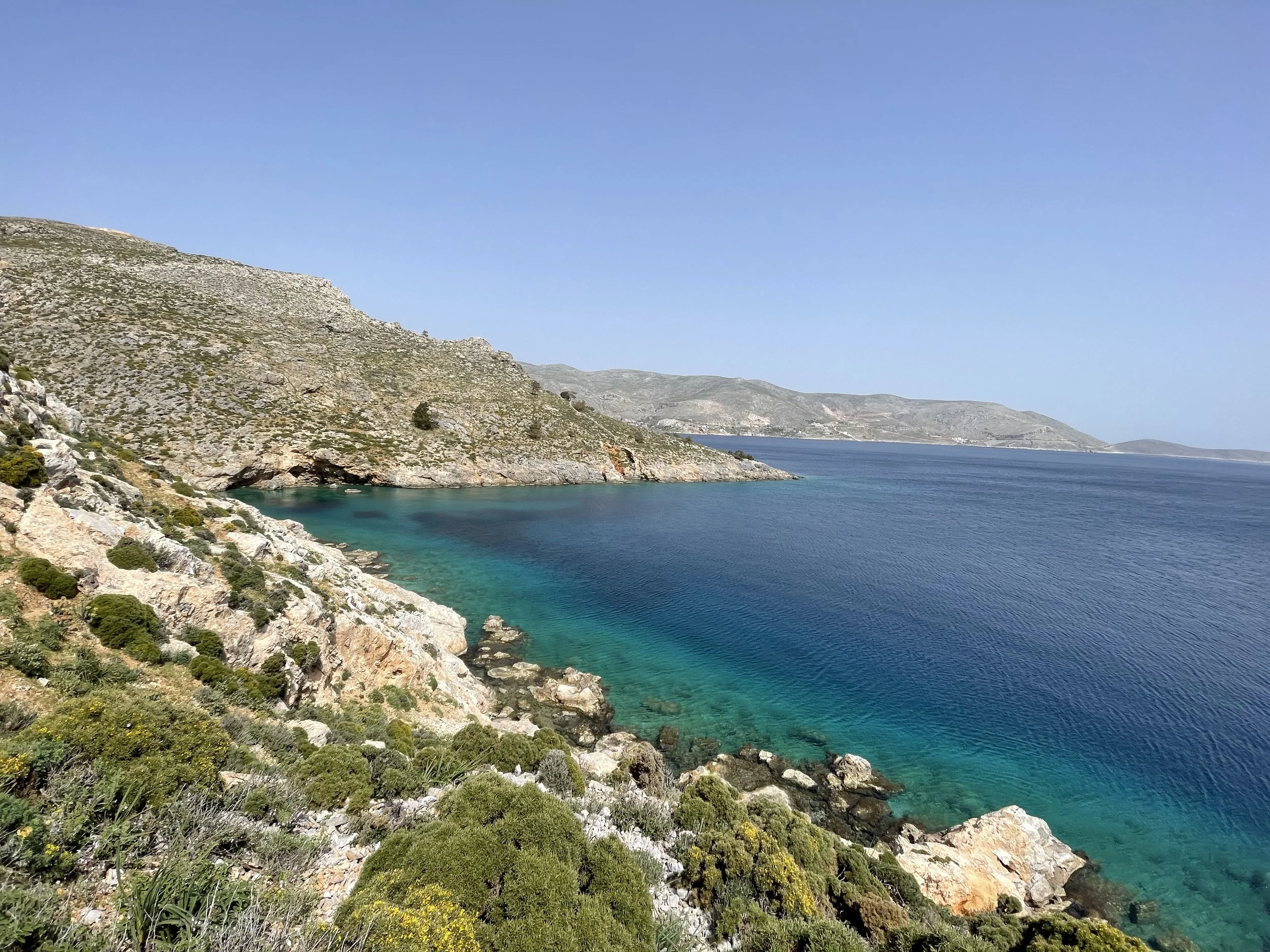
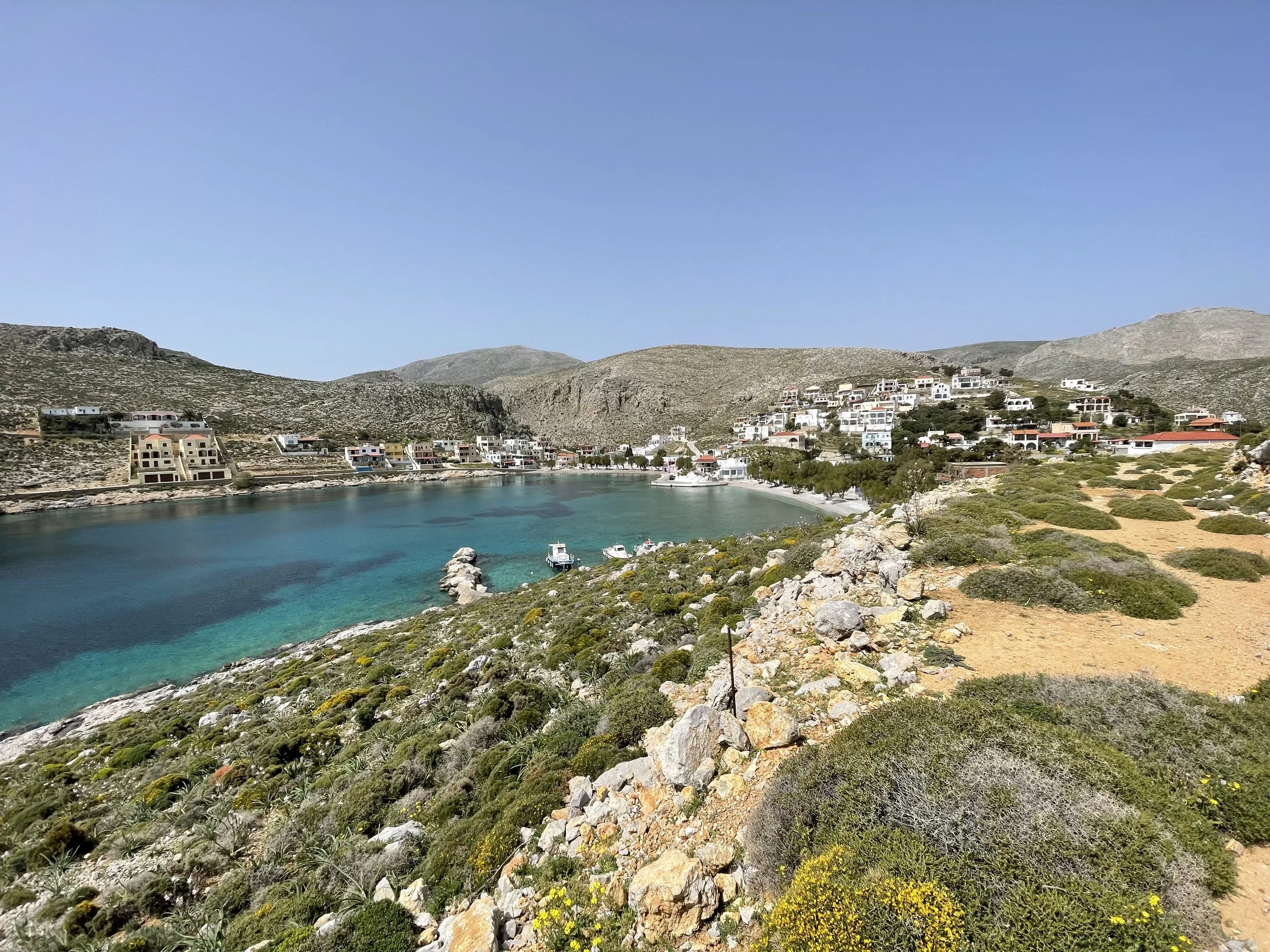
The next couple of hours floated away like the heat waves that shimmered on the horizon. The sun was blinding, and as I traversed the yellowish coastline I neither saw nor heard anything alive save the occasional fishing boat and the crunching of my footsteps. I alternated between wearing my shirt and using it to cover my head and neck, and stopped only to drink water in the shade of the occasional chapel or shrine. Eventually I arrived in the village of Vlychadia, which was in the process of preparing for the tourist season. Most of the buildings were empty but there was some activity at the beach, where a few locals were enjoying an afternoon swim. I ducked into a beachfront cafe and ordered a coffee. The server was clearly bored with the lack of customers and excited about an American patron, so he sat with me and we talked about the States, the tourist season, and his favorite types of coffee until I coughed up some euros and said goodbye.

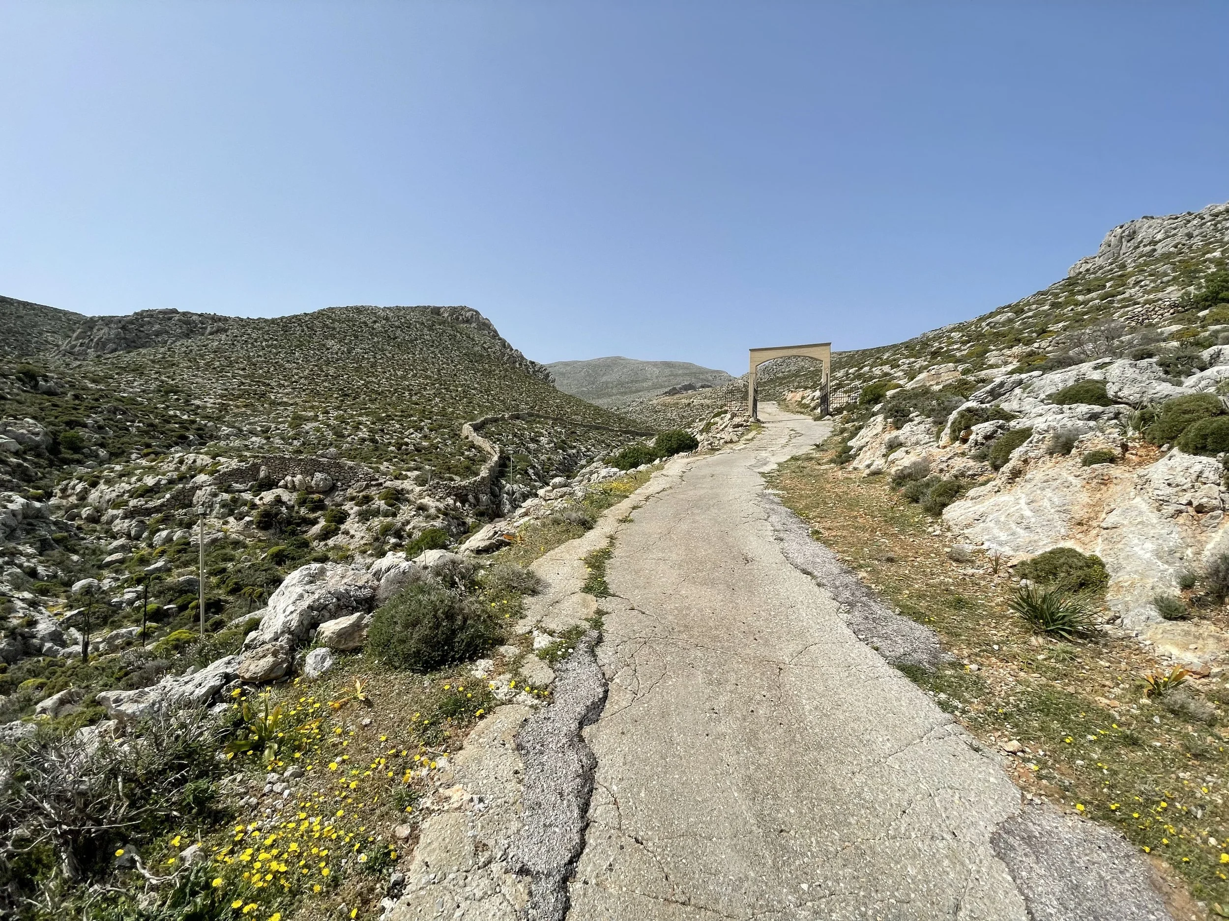
I walked up and over a hill behind the village and along the low wall of a quiet monastery, leaving the ocean behind for a bit as the trail rose into some higher elevations. The steep incline and the heat radiating off of the ground was oppressive, but I knew that the Trail’s most technical section was a few miles ahead of me, so I kept moving. At the top of the hill the road came to some scattered houses overlooking the sea. Aside from a covered tricycle that put-putted its way past me on the road, the place was deserted. The trail picked up at the furthest house, which sat on the edge of a cliff that plunged hundreds of feet to the sea. It looked like the end of the world. It was calming but depressing – as if I had seen a glimpse of where you go if you choose to forgo the type of human connections I had observed in Pothia.
I continued, feeling tired and confident and nervous all at once. I was floating through that desolate landscape, no longer paying attention to the sharp bristles of succulents digging into my legs or the scorching weight of the sun’s rays. I didn’t let myself sit for fear that I wouldn’t want to stand back up. After an hour or so at this steady pace, I came to a corner in the coast that revealed my next and final obstacle — a huge wall of limestone rising a thousand feet out of the sea. My path, from what I could tell, was to climb through a distant ravine and then traverse across the upper steps of this wall.
I hurried onwards, intimidated by the traverse. I had a nice flashback to the spider times when I got into the ravine, gaining a new eight-legged friend with every step up the steep channel. At the top of the ravine was another abandoned chapel. I sat in the shade of its little bell tower and nearly fell asleep. The traverse was just a few hundred yards down the trail. I considered quitting and walking down the dirt road on the other side of the chapel to avoid the danger of navigating the step in my exhausted state… But instead I ate a few gummy bears and downed some water before standing back up and heading towards the step.
After the church, the trail began traversing the edge of the massive face. Looking down was impressive; from where I stood, the slope plunged a thousand feet to meet the ocean below. As I walked further, the trail dropped into a little hollow in the face. Ahead of me was the technical section, which involved an incredibly exposed scramble up a series of stone ledges. I sighed in relief when I saw it – I knew it was well within my abilities, even with my fatigue. I clambered across the ledges, pulling on solid limestone features and feeling the breeze tickling my legs as it wafted up the wall from the sea below. I came to the final ledge and pulled up and over the lip above me to stand at the top of the cliff. Relief washed over me. A few more miles of trudging remained, but everything requiring real mental and physical strength was behind me. With this knowledge, I felt a renewed sense of energy as I wandered happily over the craggy landscape between the blue dots.

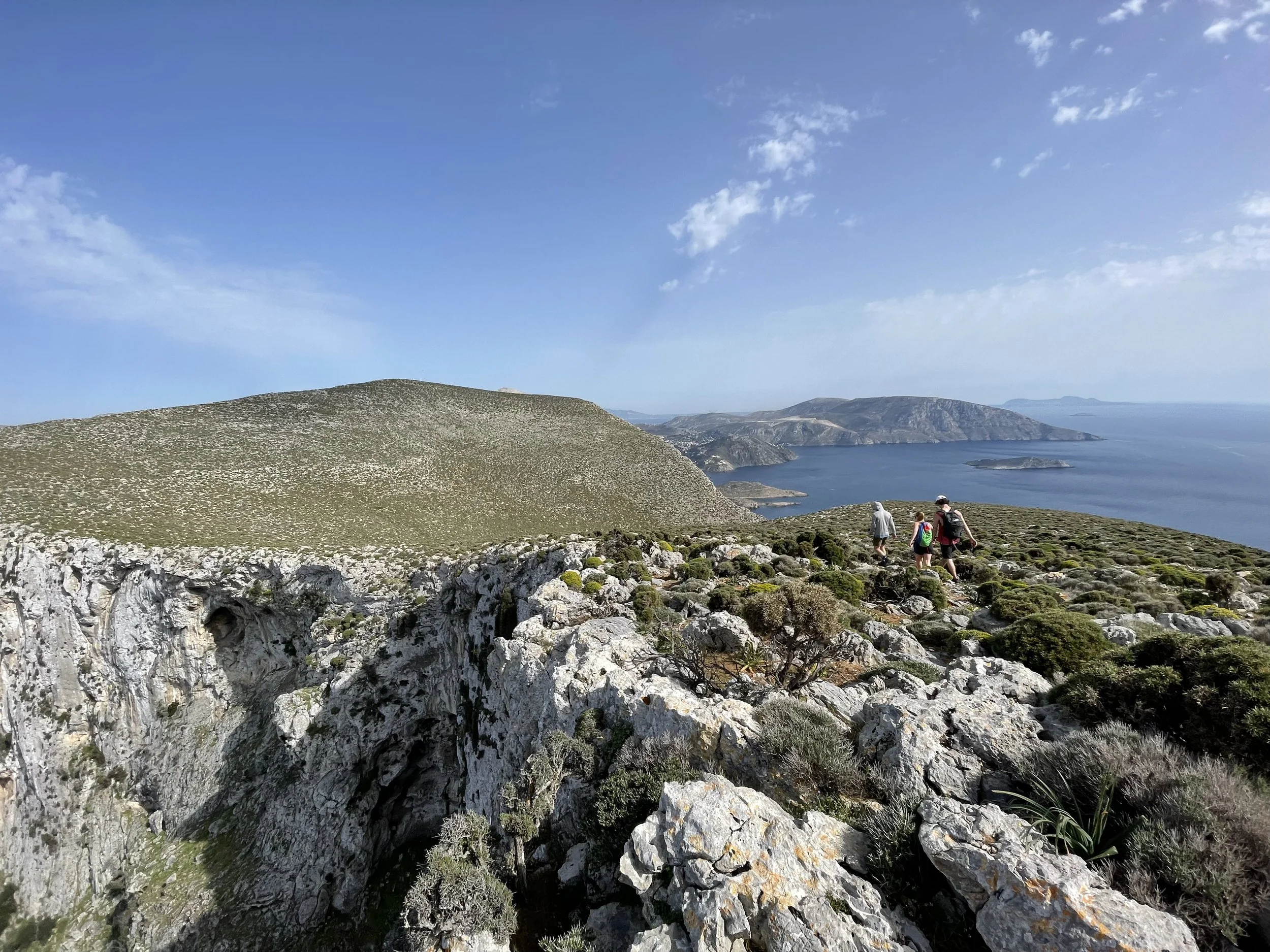
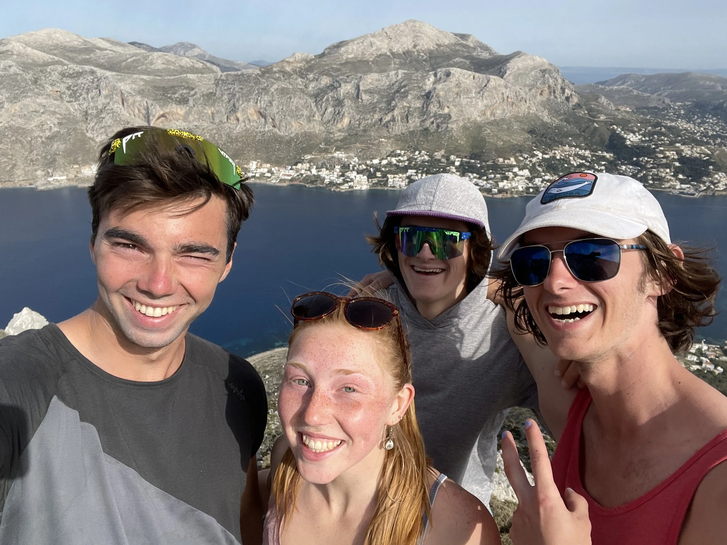
A few hours later I made it back, after 38 hours, to the house where I had begun my walk. According to my GPS, I had walked 55 miles (this number includes my walking around Vathy and Pothia and the extra walking I did when lost) and had climbed a cumulative 13,000 feet. It should be noted that although I did circumnavigate the island in this single push, the full 65-mile Kalymnos Trail also includes two additional sections, one of which goes to the highpoint of the island and one that involves a half-mile swim to the adjacent island of Telendos before circumnavigating and summiting it. I completed these two sections over the subsequent two weeks, as both would have taken me out of the way of my objective of circumnavigation. For the Telendos section, I was able to bring some students with me, which made the experience far more fun and rewarding.
No amount of words could possibly capture this experience – neither my breathless excitement at each new landmark nor the simultaneous sense of profound peace and loneliness I felt at various points can be experienced in any way except by replicating the trip. The simplest way to put it is: it was hard and fun and when I was done I didn’t want to walk anywhere ever again (I actually rented a scooter the day after I got back so that I wouldn’t have to walk anywhere). But there were deeper lessons as well, ones that I won’t try to articulate here but that will guide me for the rest of my life, like little mental blue dots. As I write this, the most surprising outcome is that I think I want to do something like this again – guess I better start saving up my days off…